Why Watersheds Link Places That Look Far Apart
Watersheds connect distant places through flowing water. Learn to trace a watershed on a map and see how ridges, streams, and downstream routes fit together.
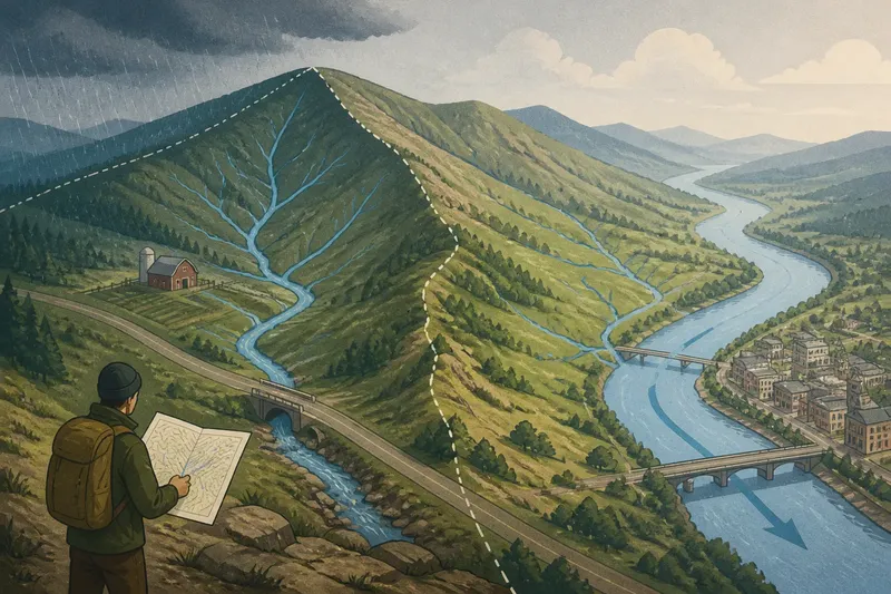
A rain shower darkens a hillside, then gathers in a roadside ditch and slips beneath a bridge toward a river no one can see from the slope. A watershed map helps trace that journey: it shows how a ridge separates flows and how land on the same side can connect to places far downstream. The link is not straight-line distance but the path water takes.
What Is a Watershed?
A watershed is the area of land that drains water toward a shared outlet. Depending on the map and local usage, that outlet may be a small stream, a larger river, a lake, an inland basin, or the sea. A small watershed can sit inside a much larger one: the land draining to a creek is also part of the area draining to the river that receives the creek.
Think of the boundary as the high ground around a basin. Rain falling on one side generally flows toward one channel; rain falling on the other side heads toward another. The high ground can be a mountain ridge, a low rise, or a subtle divide across a broad plain. It need not look dramatic on the ground to matter to drainage.
Watershed, drainage basin, and catchment are often used for the area that contributes water to a channel or outlet. Terminology can vary by place and mapmaker, so read the map legend and any local definitions. The basic question remains: which land drains to which outlet?
How Does a Watershed Divide Flow?
A watershed divide separates neighboring drainage areas. It is usually traced along higher terrain between channels, not along the river itself. Water on one side of the divide descends through one network of gullies and streams; water on the other side joins a different network. In this way, a ridge divides flow even as it links the slopes on either side to distinct destinations.
On a topographic map, contour lines show elevation. Their bends often form a V shape where they cross a valley, with the V pointing uphill. Ridges appear differently: contour lines curve around higher ground, and the land falls away on both sides. Follow the higher ground between two neighboring valleys to estimate the divide, then check which way each valley descends.
A watershed boundary is not always a crisp line you can identify from a small-scale map. Broad, gently sloping terrain may make the divide hard to distinguish, and a map may omit small channels. For a general geographic reading, identify the likely high ground and compare the directions of the mapped streams rather than treating every boundary as exact.
How Can Distant Places Share a Watershed?
Places can look far apart on a map yet belong to the same watershed because water travels through connected channels. A slope near a watershed’s upper edge may feed a tributary, which joins a larger stream and eventually a main river. The downstream place is connected to that slope by the drainage network, even if a mountain range, a long valley, or a stretch of lowland lies between them.
That connection is directional. Upstream land contributes runoff toward downstream channels; downstream land does not send ordinary surface flow back uphill to its source. A map therefore reveals a relationship between places, not just a shared outline. One location may sit beside a river while another lies near a small headwater stream, yet both can be part of the same river basin.
Consider an invented situation: imagine a hillside farm above a small creek and a town beside the larger river the creek joins. Trace the creek downhill on a map, then follow the river past the town. The expected observable result is a continuous route of connected channels from the hillside toward the town, showing their upstream–downstream relationship without implying that they are nearby.
Water can also move through groundwater, canals, reservoirs, or engineered diversions, and those pathways may not match a simple surface watershed map. For the map-reading task here, follow the natural surface drainage shown by the available channel and terrain features.
How Do You Follow a Watershed on a Map?
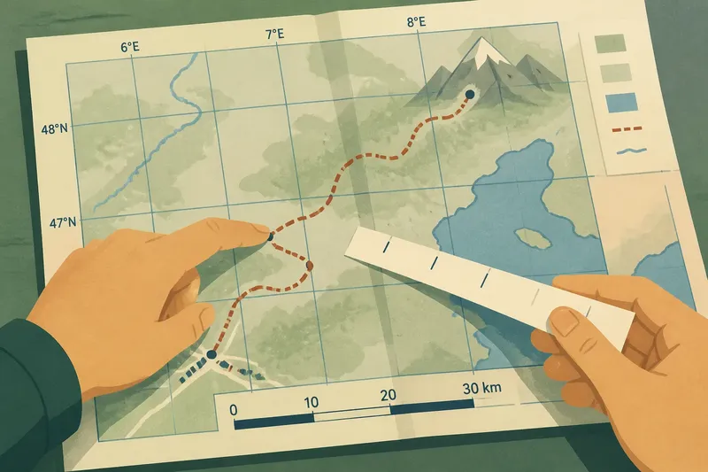
Start with a place you can identify, such as a village, a stream crossing, or the mouth of a tributary. Then trace its channel toward a larger watercourse. Read the terrain around the channel as well as the blue lines: the land’s shape explains why water enters that stream rather than a neighboring one.
- Find the outlet. Choose the river mouth, lake, or other destination that defines the basin you want to follow.
- Trace the main channel upstream. Follow its mapped course inland, noting where tributaries join.
- Pick a tributary or headwater. Follow a smaller branch toward its source area instead of jumping across the map to a nearby stream.
- Inspect the surrounding terrain. Use contour lines, shaded relief, or a terrain layer to spot the high ground between neighboring valleys.
- Compare the opposite slope. Check whether runoff on the far side of that ridge leads to a different channel and outlet.
- Mark the sequence in words. Write the route as source area, small stream, tributary, main river, and outlet; this keeps the drainage connection clear.
- Check the map legend and coverage. Confirm what the map shows, and avoid treating an omitted small channel as proof that no drainage connection exists.
A paper topographic map works well for this because its contours make the landform visible. A digital map with a terrain or elevation layer can help when the contour pattern is unfamiliar. A plain road map may show rivers but not enough relief to identify the divide confidently.
What Can a Watershed Map Tell You?
A watershed map can clarify why locations share a drainage route, where one basin gives way to another, and which tributaries feed a larger river. It also gives a useful frame for comparing places that are distant by road or separated by administrative boundaries. If two communities lie along the same connected river system, the map shows their physical relationship without claiming that they share the same landscape, culture, or local concerns.
It can also help distinguish neighboring basins that appear close together. Two streams may run in opposite directions from a ridge and reach entirely different outlets. The ridge is a boundary for surface flow, while the valleys on each side belong to separate networks. On a regional map, that difference can be easy to miss if attention stays on the lines representing rivers alone.
A watershed map does not, by itself, explain water quality, flood timing, water rights, or the effects of a particular land use. Those questions depend on local conditions and additional information. For a geographic reading, use the watershed to establish which places are connected by surface drainage, then keep other claims separate from that map-based relationship.
Which Questions Help Read Watersheds?
Is a watershed the same as a river basin?
The terms often refer to the land draining toward a shared outlet, though a map or local authority may distinguish them by scale or usage. Look for the map’s definition and identify the outlet being discussed before comparing boundaries.
Does every watershed end at the ocean?
No. Some drainage networks reach the ocean, while others empty into a lake or inland basin where water does not flow onward to the sea. Follow the mapped channels to their actual endpoint rather than assuming every river reaches a coast.
Can a ridge be a watershed boundary?
Yes. A ridge or other line of high ground commonly separates land draining to neighboring channels. On a map, compare the valleys and slopes on both sides to see which direction their streams descend.
Can two places in one watershed be very different?
Yes. A watershed describes a surface drainage connection, not a shared climate, culture, or land cover. A headwater slope and a downstream floodplain can belong to the same basin while looking and functioning quite differently.
Why the Connection Matters
The watershed is a way to read a landscape from its high ground toward its outlets. It turns scattered places into a sequence: slope, tributary, river, and destination. That sequence is especially useful when a map’s visual distance hides the fact that water links an upland area to a faraway downstream one.
To follow a watershed on a map, trace channels toward their outlet and use the terrain to see what feeds them. The main phrase, watersheds link places, describes a physical relationship rather than a claim that those places are otherwise alike. A ridge can separate one flow from another; the connected channels on each side reveal where the water goes.